Tour de la Colle
Sisteron Medium
Tour de la Colle
4h
11,9km
+742m
-742m
Loop
Embed this item to access it offline
Description
- Take the departmental road D 53 on the left for about 50 meters. Go behind the police station and take the hairpin bends track going up into the Molard’s forest massif (GR markings). On your way, the botanical trail offers many interpretations.
- At the aerial, leave the going down rocky track and completely bend on your right towards the ascending track. Overpass the hut and the viewpoint indicator and go straight on the path leading to the Molard.
- At the Molard, go up the path towards the Rocher du Turc and the Mairie pass. Reach the ridge overlooked by oaks and box trees. Go on straight on the ridge and overpass the Rocher du Turc heading to the Mairie pass. A few meters further, the ridge transforms into a long descent through pine trees.
- At the « Col de la Mairie » - the Mairie pass – signpost, turn right on a path leading to Sisteron (yellow markings). At the forest exit, cross the marls and turn right once the junction with the track reached.
- At the junction with a tarred road – called Chemin de la Marquise – turn right and follow the road towards Sisteron.
- Departure : Behind Sisteron’s police station.
- Arrival : Behind Sisteron’s police station.
- Towns crossed : Sisteron, Val Buëch-Méouge, and Bevons
Forecast
Altimetric profile
Recommandations
- Avoid doing this hiking when wet or muddy weather. (The marl crossing is steep on the way back.)
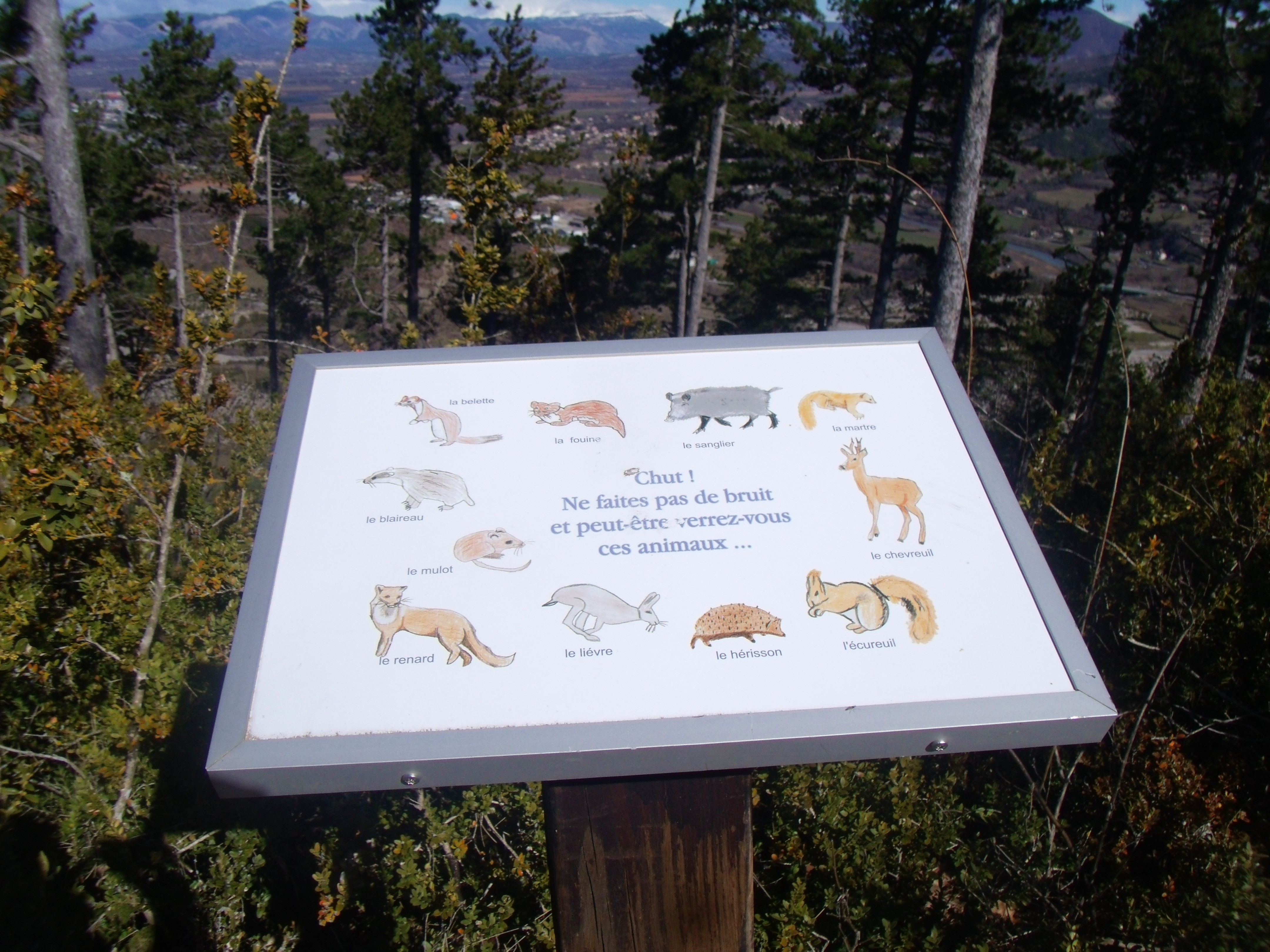
- All along the hiking, explanatory boards about plants are located on the north and the south sides. Hikers will be able to distinguish the flora depending on the exposure. The Molard is also populated by a varied fauna from invertebrates to many birds and many other species. In this way, foxes can be seen much as hares and deer according to the season. But you must learn how to be patient, silent and observant.
- Visit of the Citadel of Sisteron advised.
Information desks

1 place de la République, 04200 Sisteron
Access and parking
From Gap (50 km), follow the national road N 85 and take the motorway A 12 from La Saulce to Sisteron.
Parking :
Police station or town hall parking lot in Sisteron
2 points of interest

 Flora
FloraMolard botanical trail.
The Molard botanical trail offers an enjoyable walk. Go in search of the region trees, shrubs, and plants. The interpretation boards allow you a better understanding and identification of the different plant species you can find during the trail.
- Panorama
The Molard viewpoint indicator
The Molard viewpoint indicator offers a wonderful outlook onto the village and the valley of Sisteron to the Laraganais. Thanks to the viewpoint indicator, you can easily notice and identify the different surrounding summits.
More information
Report a problem or an error
If you have found an error on this page or if you have noticed any problems during your hike, please report them to us here: