Riou et Revuaire
Description
- Take the road that goes up to the village.Cross it by walking along the main street.Turn right to reach the path in the black marls.
- Continue along the path laid out flat, reach the bank of the Riou and go up the gorge on the right bank (leave the small stone bridge on the right).
- Continue along the torrent, take the left bank (tunnel passage). After a series of switchbacks to reach a junction ("Saume Longe" post).
- Walk down the path on the left to the bed of the torrent. Cross the footbridge and climb through the undergrowth until you reach a track which leads you to the Maison forestière de Jubéo. Continue to the parking lot (890 m)
- Cross the picnic area and turn left on the path that climbs through the pines for reaching the Taillefer pas, also called, Col de Revuaire (1054 m).
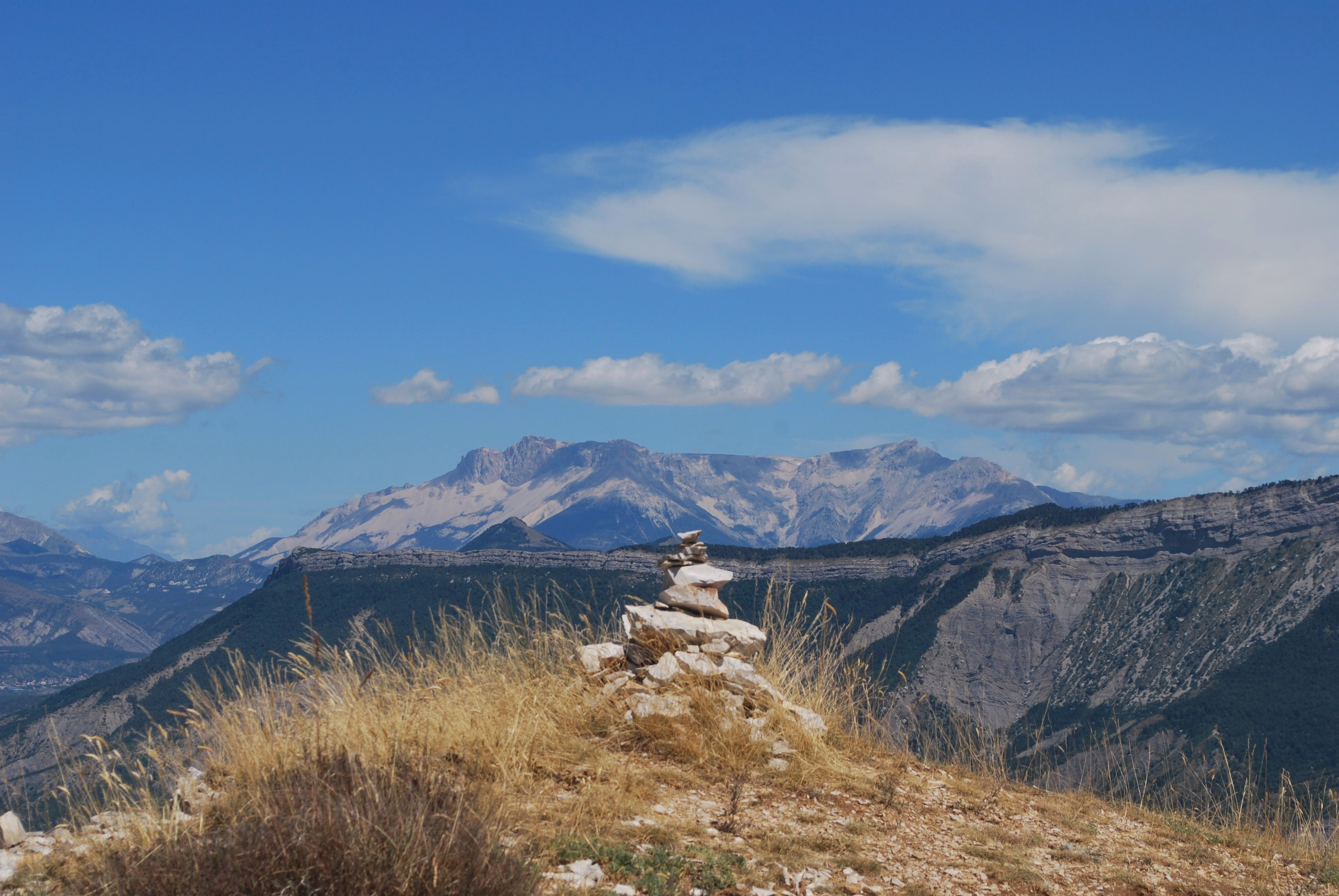
- Climb the right path for reaching the summit ridge of the Revuaire (1302 m), be careful, the cliff is very steep.
- Go down to the Col du Taillefer by the same path. Take the path to the right which, after a bend to the left, goes crosswise (the path is not well marked, follow the cairns).
- Further the path bends to the left in the forest Bois du Révuaire. Wind down a series of rocky terraces and find an old mule track well marked and bordered by dry stone walls until you reach the path of the gorges upstream of the small bridge. By the outbound route, return to the starting point.
- Departure : Parking lot, Saint-Genis
- Arrival : Parking lot, Saint-Genis
- Towns crossed : Garde-Colombe and Savournon
Forecast
Altimetric profile
Recommandations
-
Possibility of swim in the gorges
Information desks

Transport
- Let’s limit our trips and use public transportation and carpooling: https://zou.maregionsud.fr
Access and parking
From Serres (9 km), take the D 1075 then the D 94 towards Garde-Colombe Saint-Genis.
Parking :
5 points of interest

 Lake and river
Riou Gorges
Taking its source in the heart of the national forest of Beynon, the Riou dug its gorges. The Gorges du Riou connects the Jubéo Forest and the village of Saint-Genis.
- Lake and river
The Riou
The Riou takes its source at the bottom of the valley, digging beautiful gorges. It then comes to fill the Riou lake, very popular spot among tourists and locals during hot Summer days.
 Flora
FloraBeynon Forest
Located between Savournon and Saint-Genis, the Forest of Beynon impresses with its huge pines. It also abounds in almost invisible species which are very remarkable either by their rarity or their specificity. Thus, it is possible to find there: Mougeot's whitebeam, astragalus de Montpellier or vesicaria, pectinate quitch and many other species.
 Geology
Roc Taillefer
Located above the Jubéo car park, the Roc Taillefer stands out with its steep relief walls. This site offers about twenty climbing routes on limestone vertical sites (from 4c to 6b).
 Summit
Revuaire
The Crêtes de Revuaire and its summit (culminating at an altitude of 1306 m), overlook the municipalities of Bersac and Savournon. From this point, a magnificent view opens on the Channe valley and on the beautiful surrounding mountains such as Chabre, Arambre or Aujour.
More information
Report a problem or an error
If you have found an error on this page or if you have noticed any problems during your hike, please report them to us here: