Crête de Géruen
Description
-
From the parking lot, at the “Col de Fontbelle” post, follow the track towards “Crête de Géruen”. Pass an ONF ( National Forest Office) fence and and follow along the Maison Forestière de Fontbelle. Continue on the track for about 700 m, and take then a path to the right which gradually leads to the Géruen ridge.
-
Ignore the small footpaths on the left and continue on the same path. The last bend runs along the rocky face and leads to the ridge.
-
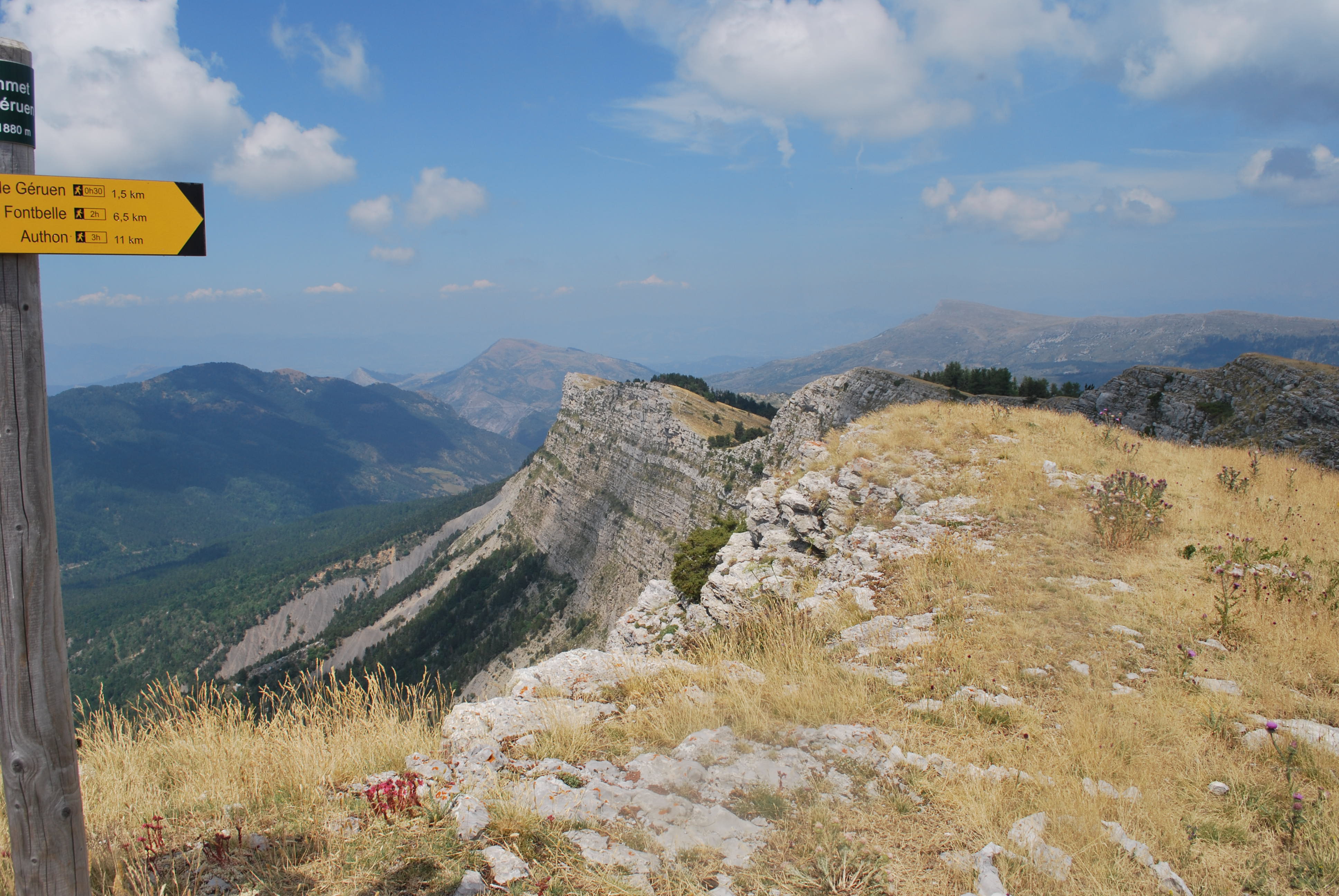
On the Crête de Géruen (1746 m), take the path on the right towards “Sommet de Géruen”, then at the next intersection (“Hubac de Géruen”), continue to the right following the same direction to join the edges of ridges (beautiful view on the cliffs).
- Carruy on your ascent all the way to the summit by following the milestones ("Sommet de Géruen - 1885 m" post).
- Hike back down following the same route.
- Departure : Col de Fontbelle - parking du col, Authon
- Arrival : Col de Fontbelle - parking du col, Authon
- Towns crossed : Castellard-Mélan, Authon, and Hautes-Duyes
Forecast
Altimetric profile
Recommandations
- Caution: Pastoral zone, shepherd dogs are active.
- The ascent is gradual, without difficulty.
- During Summer, a profusion of flowers adorns the green ground. Most of these flowers are protected; do not pick them.
- You may simply access to the Géruen ridge, but the most interesting part (landscape, flora and fauna) is further on, towards the Géruen summit.
Information desks

1 place de la République, 04200 Sisteron
Transport
- Think about public transport and carpooling: https://zou.maregionsud.fr
Access and parking
From the roundabout north of Sisteron (27 km), take the D 951 then the D 3 to Saint-Geniez. Cross the village and continue on the D 3. Cross Authon and continue to Col de Fontbelle
Parking :
1 point of interest

 Summit
Géruen Ridge
At 1880 m, the Crête de Géruen offers a magnificent panorama. From its summit, it is possible to discover the highlands of the Provence. The view on the various surrounding reliefs is also magnificent (the Monges, the Montagne de Lure, the Cloches de Barles ...).
More information
Report a problem or an error
If you have found an error on this page or if you have noticed any problems during your hike, please report them to us here: