Mare Mountain
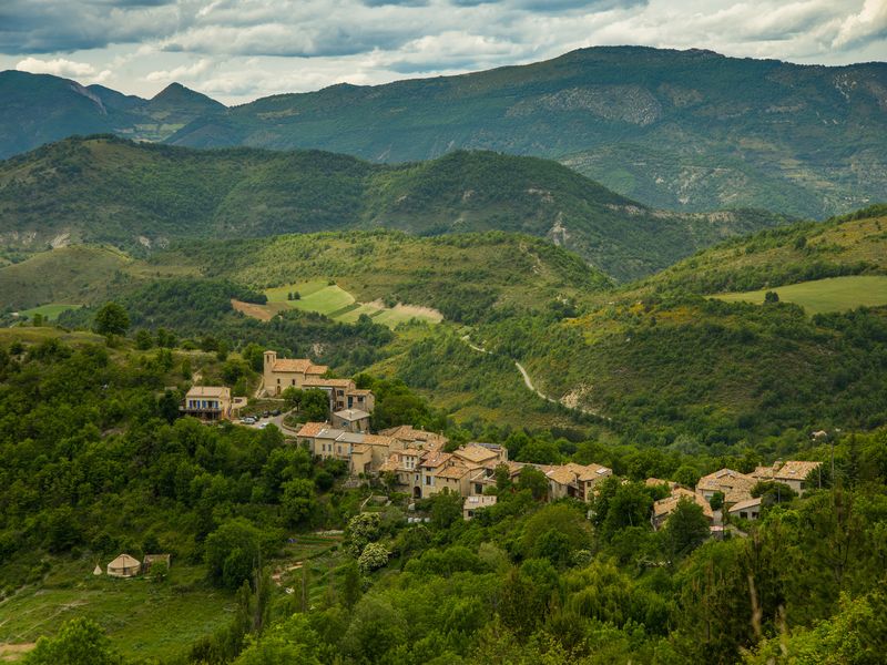
Éourres Hard
Hard
Mare Mountain
5h
12km
+1023m
-1022m
Loop
Embed this item to access it offline
Description
- You can park your car at the village entrance and hike up the path on your right. This path leads to the village information board. Pass by the fountain and take the 2nd path on your left near the « Montagne de Mare, Col St-Pierre par la Sapie » signpost. Start onto a small path going through pastures.
- Go on the path leading to Mare Mountain and ignore the path on your left going down to the Damias. The path crosses pastures and follow it until St Pierre pass. A faster but more athletic variant trail exists by taking the path on your right heading to Mare Mountain.
- Straight forward, cross two clearings (1363 meters). They are located at the end of a small valley. When the second clearing crossed, take the undergrowth way on your right. Here, you can enjoy the beeches forest coolness.
- In a small clearing near a ridge, go on your right on the hiking up way. Go to the end of the clearing (1403 meters) and take another path on your right, ignoring a wide way on the right.
- At the end of the way, take the path going down to a cairn (1420 meters).
- When you reach Alpine grasses, keep looking for a signpost on the left ridge. Go to it by crossing the slope. From here, starts the most athletic part. At the signpost, hike up and follow the ridge on your right. The rise is quite tough, but it is worth the effort if you want to see a stunning view. Go along the fence leading to the summit. At the signpost, do not follow Eourres way back but continue to follow the fence.
- Still follow the fence on your left a few meters before the summit. The path goes down a stiff slope until the pass. At the pass, go down straight forward on the ridge. At the signpost near a huge rock (1502 meters), go down on your right. The steep paths lead to Verdun pass.
- At the markings ways junction, turn right towards Eourres. The path slightly goes down and becomes more and more craggy. At Verdun pass (1314 meters), braves ones can hike up to « Pied du Mulet » and then go down to Eourres by old tracks. Otherwise, you also can cross the ford on your right (1201 meters) and go down to the village.
- Towns crossed : Éourres and Saint-Vincent-sur-Jabron
Forecast
Altimetric profile
Information desks

1 place de la République, 04200 Sisteron
Access and parking
From Laragne-Montéglin (23 km), follow the departmental road D 942 and the departmental road D 24 at the south-west until Eourres.
Parking :
Parking : There is a parking lot beneath the Eourres village (cars are prohibited in the village).
More information
Report a problem or an error
If you have found an error on this page or if you have noticed any problems during your hike, please report them to us here: