Les Balcons de Durance by bicycle
Sisteron Medium
Les Balcons de Durance by bicycle
3h30
47,1km
+697m
-695m
Loop
Embed this item to access it offline
Description
- From Sisteron, cross over the Durance towards the Baume district and follow the departmental road D 951 leading to la Motte du Caire. Reach the Sasse bridge (8,25 km).
- At the Forge (527 meters), follow the departmental road D 951 for about 9 km.
- Ignore Clamensane on your right and go on until La Motte du Caire.
- At the village entrance (690 meters) turn left and take the departmental road D 104. There is a short rise of 1,7 km until Melve.
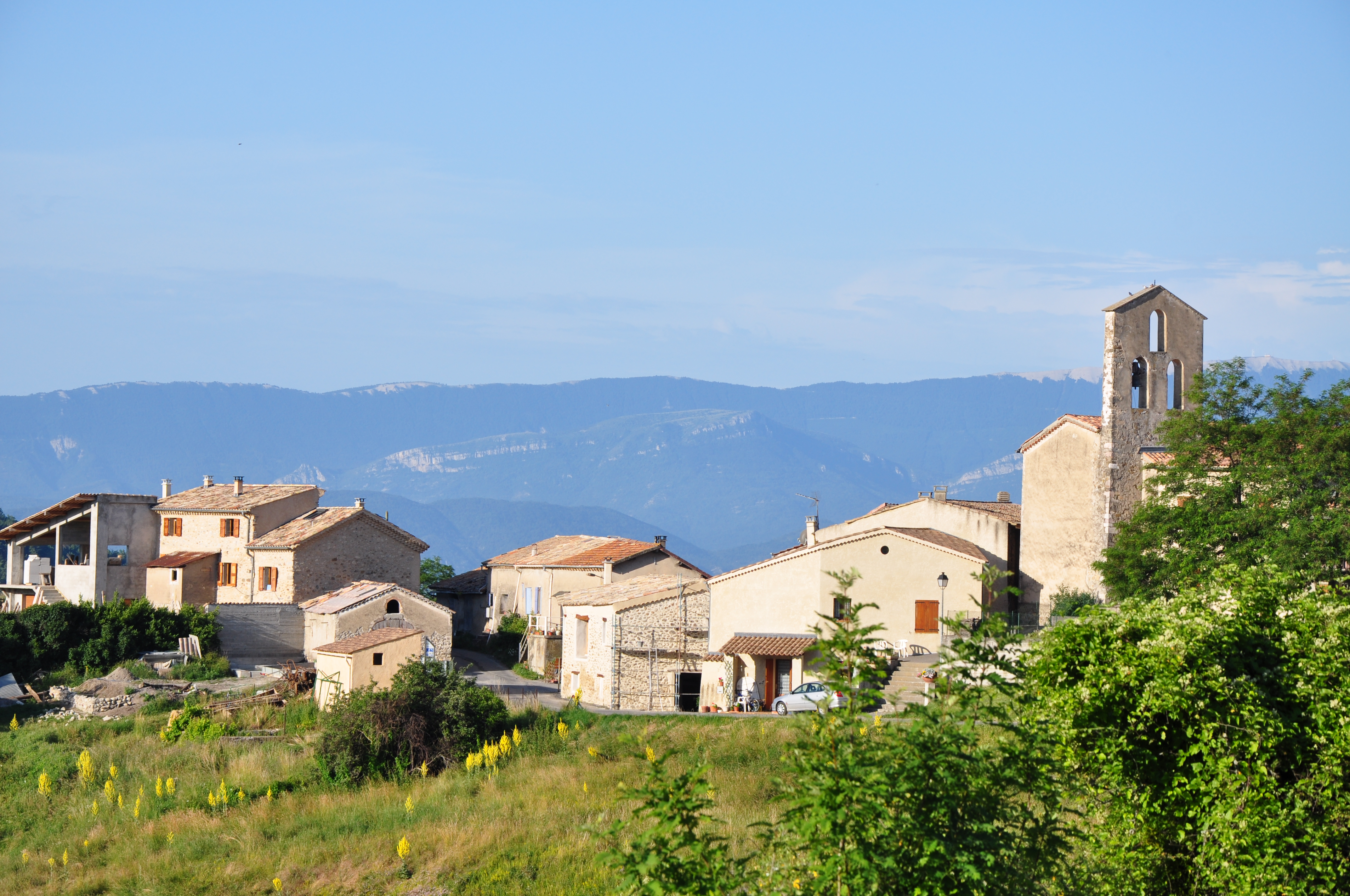
- Just before the village entrance (833 meters) from the departmental road D 304, go on your left once again. Go through Sigoyer village (810 meters), (there is a viewpoint indicator and a panoramic view onto the Durance valley). Ignore the D 654 on your right.
- Pass by the Grêle pass (728 meters) and go down to the village of Vaumeilh.
- Turn left into the village and go on until Valernes (600 meters) and reach the departmental road D 304A in the Sasse valley.
- From the departmental road D 304A on the left, turn 100 meters further on the right to go back to the departure point in Sisteron.
- Towns crossed : Sisteron, Valernes, Nibles, Motte-du-Caire, Melve, Sigoyer, and Vaumeilh
Forecast
Altimetric profile
Recommandations
- The Sisteronais Buëch is labelled « Espace Cyclosport » by the Cycling French Federation and meet some welcoming quality criterion for road cycling cyclist.
- This circuit is added to the Hautes Terres de Provence one.
- Break recommended at Sisteron’s citadel: citadelledesisteron.fr
Information desks

1 place de la République, 04200 Sisteron
Access and parking
From Sisteron (1 km), go out of the tunnel under the citadel and take the departmental road D 951 towards La Motte du Caire and reach the Baume bridge.
Parking :
Parking lot on the right of the Baume bridge, alongside the departmental road in Sisteron.
1 point of interest
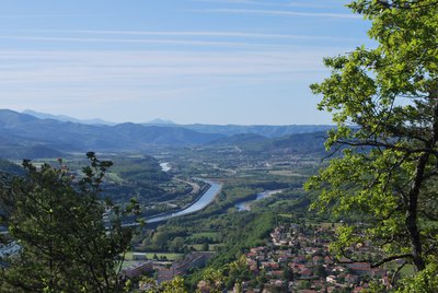
La Durance - CCSB  Lake and river
The Durance River
More than a mere river, the Durance is a force of nature. From its source in Mongenèvre at an altitude of 2300 metres it rolls its way over 302 kilometres until it finally flows into the Rhône. Over time, there has been greater control by man over the river, particularly with the construction of the Serre-Ponçon dam, and it is an essential artery for the Hautes-Alpes.
Source : www.hautes-alpes.net
More information
Report a problem or an error
If you have found an error on this page or if you have noticed any problems during your hike, please report them to us here: