Raton’s Ridges

Description
- The Raton’s hamlet (716 meters) where rapid streams water flows into is located at the south of the dell. It is also the place where the Baudon river starts and it is related to the Eygues river. From the hamlet, take the left path and start a long climb up. This path was the old access to those houses which are only ruins now.
-
Once the Replat reached (921 meters), go on the path until the end of it and then take an enjoyable way which climbs up into a bank and reach a small ridge. It brings you to the pastures of Staton.
-
When Staton’s – pronouced ‘’ Taton ‘’ by locals – sheepfold can be seen, go straight forward. On your way, the coolness of a spring can be felt near the ruins and the pass. At the pass (1124 meters), take the acsending path leading to the right side of Gravières mountain. It is a path with a lot of small stones.
-
The path leads to the Pas de la Pousterle situated at 1364 meters high. - In Occitan, ‘’Pousterle’’ means a small door or a hunting station. – Reach the ridge and continue on the right side of it.
-
From La Sapie (1497 meters), follow the track of « la passière de la Sapie ». The panoramic view offers a wonderful north sight on Saint-Romans mountain, the village and the ruins of Pommerol. The left path is hard to see – an information board is near the path. – There are a few stairs to walk down, be careful of the roots, the slope is quite steep. Then, an easier path leads to la Fromagère pass (stay on the main route.).
-
At la Fromagère pass (1091 meters), take the path on your right and follow right away the left one leading to « Le Grand Béal ». At the signpost (781 meters), reach the track and turn left towards Raton to go back to the departure point.
- Towns crossed : Rosans, Verclause, Cornillac, and Pommerol
Forecast
Altimetric profile
Recommandations
- Good shoes and warm clothes are essential. Some areas are exposed to wind.
- Caution : the path of La Passière de la Sapie is steep.
- Caution : Pastoral zone, shepherd dogs are active.
- Another track of the Raton’s ridge is possible.
Information desks

Access and parking
From Nyons (at 41 Km), drive towards Gap on the departemental road D 94. Then take the departemental road D 25 in the direction of « Col de la Fromagère. » After more or less 3 Km, take a smaller road heading to the Raton’s hamlet. The road quickly turns into a track and ends up at the hamlet.
Parking : Parking lot, « Hameau de Raton ».
2 points of interest
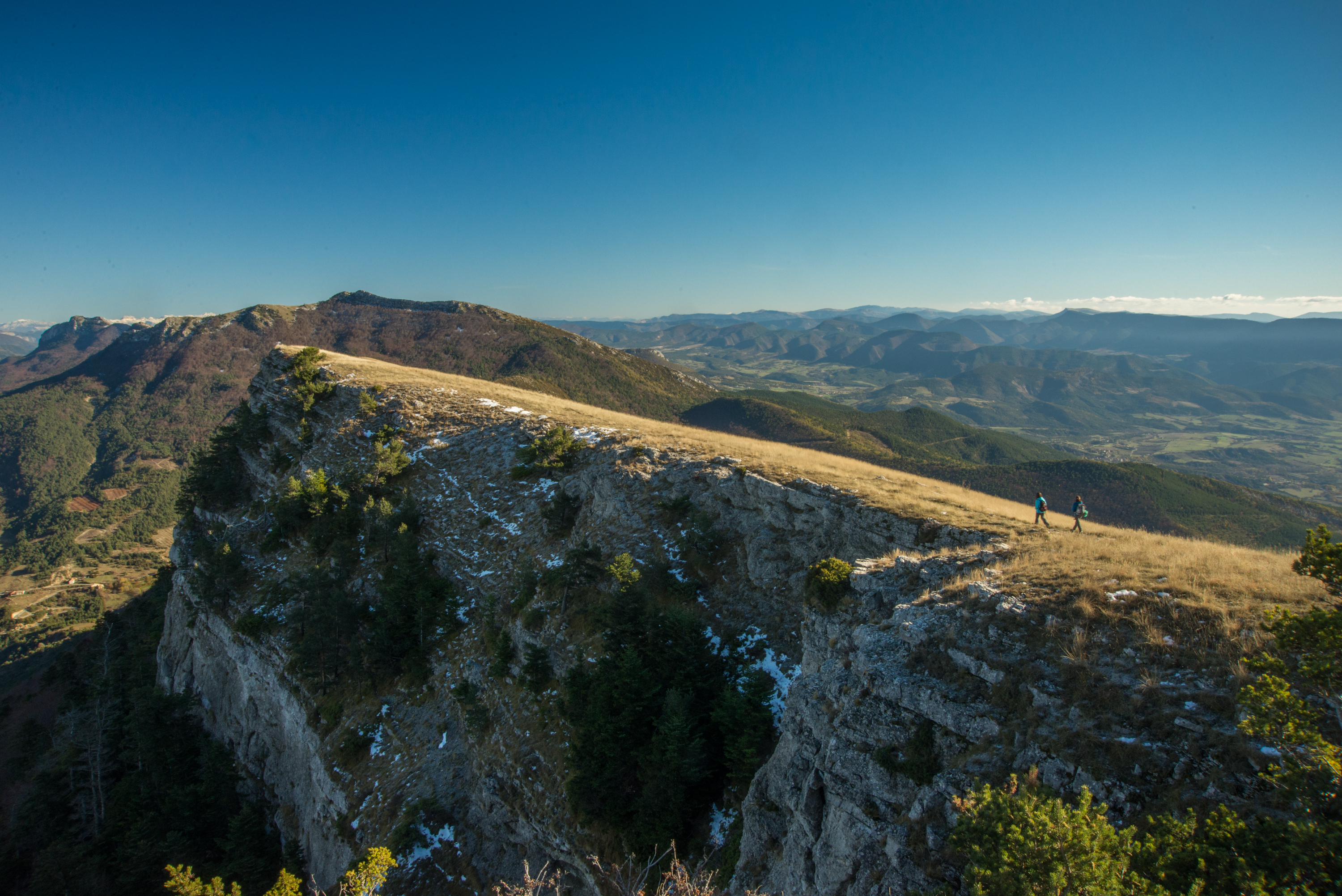
La crête de Raton - Ricardo Flores Espinosa  Summit
Raton Mountain
Located at Rosans’ north-west, Raton’s mountain offers a 360° panoramic view from it’s ridge.
This mountain oriented east-west divides the Rosanais valley from L’Oule valley. It’s shape is caracteristic from the Jurassic period. The north side (ubac) is a rock slide area including a fir trees wood in the upper part and a pine trees one beneath this area. On the summit of the south side (adret) greenery is lacking a lot. There barely is some grass. Lower, an area of box trees, broom flowers and oaks grows. Torrents makes the mountain’s side craggy.

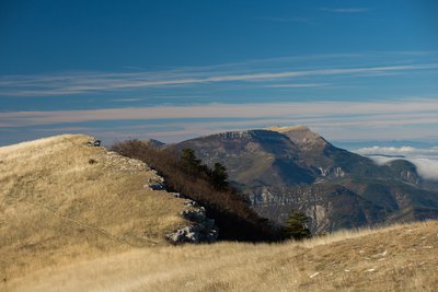
 Pass
PassPommerol’s pass
Pommerol pass is a crossing point between Les Hautes-Alpes and La Drôme, two French departments. Also named Col de la Fromagère, the pass is reachable from the tracks of Suquet and Raton’s ridges. The pass overlook the public forest of Eygues.
More information
Report a problem or an error
If you have found an error on this page or if you have noticed any problems during your hike, please report them to us here: