Saint-Cyr peak
Val Buëch-Méouge Medium
Saint-Cyr peak
5h
10,6km
+808m
-808m
Loop
Embed this item to access it offline
Description
- From the fountains, go on the road hiking up to a fork upon the village. The fork transforms into a path.
- Turn left – at the signpost « Pic Saint Cyr » - and go on the steep wide path. You can sometimes enjoy the path when it crosses some hairpin bends until a forest house.
- Turn right on an old sledge track (which was used to transport heat wood). In a wide bend, hike up into a bank where the path ends up at Saint Pierre pass (1269 meters).
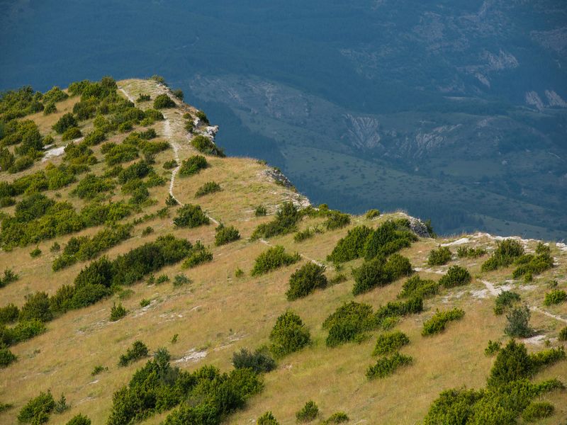
- On your right, take the steep forest path crossing « le pas du Loup » - a curious way between rocks - and go on the rise. Hike up on your right a stair like path and admire the panoramic view from Saint Cyr peak (1365 meters). Go down at the junction.
- Reach the ridge and go down along the path until a box trees area. After a rocky part, reach the signpost (950 meters, it is quite visible uphill).
- Turn off on your left and follow a path more or less visible. Cross an old pine wood leading to a clearing.
- Turn right and reach a wide tilted plateau.
- Go along the wide track on your right, which will soon become a slope going down to the fork taken before. Go back to the parking lot.
- Towns crossed : Val Buëch-Méouge and Saint-Pierre-Avez
Forecast
Altimetric profile
Information desks

Place des Aires, 05300 Laragne-Montéglin
Access and parking
From Laragne (7 km), take the departmental road D 942 to the south. Pass by Casino supermarket and cross over the Buëch river before turning on the departmental road D 124 leading to Antonaves.
Parking :
Parking: Antonaves parking lot.
1 point of interest

 Geology
Saint-Cyr peak
Saint-Cyr peak offers a breathtaking view on the surrounding hamlets. When the weather is good, you can also observe from its ridge Ventoux Mount’s hilly area, the Platte summit and Chabre Mountain.
More information
Report a problem or an error
If you have found an error on this page or if you have noticed any problems during your hike, please report them to us here: