The rock of the eagle
Description
-
From the fountain in Ribiers ,follow the direction of Sisteron and take the first road on the right. After the cemetery and the bridge, take the road on the right towards "les Charles". 3 hairpin bends further (you may park on the right along the road to avoid a round trip), follow the road for 250 m then branch off to the right and enter a field. Walk along it on the opposite side, then cross a dell (often dry stream) across the forest edge . Climb the slope through the dry lawns then reach an old orchard where the slope softens. Go up to its top (large stone), then continue ascent by slanting to the right. The route winds through dry lawns, passes along a water reservoir and then runs along a hedge between two meadows. It continues through an undergrowth of oaks and junipers until it reaches a track.
-
At the junction with the track, turn left. At the next crossroads, follow the right track.
-
Ignore the different paths and follow the main track.
- At the intersection, turn right on the perpendicular track. A few steps further, take the path to the left in thick undergrowth. It leads to the path of Pierre Impie.
- Then turn right, pass the bend and the fence. The balcony track overlooks the Buëch valley and the orchards.
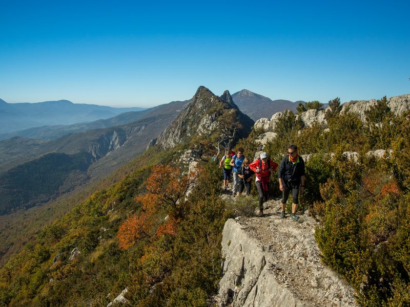
- The track gives way to a path that climbs rapidly. It skirts the Rock of Pierre Impie. You may see climbers on this impressive stone wall. The path is quite steep and passes through some slippery scree.
- Once on the ridge, pay attention, don’t be distracted by the panorama while walking. The ground is quite rocky and a few rocky stairs follow one another. At the end of this ridge for a while, you will need to use your hands for progressing. The most curious among your group will go on the right to see a small gravestone on a stratum.
- At the end of the ridge, a shady path leads down to Ubac. A few switchbacks follow one another, some of them quite steep.
-
On the way out of the woods, walk along a fence. Stay straight on the slope, cutting several cross tracks.
-
When there is no more path, it is on the right; a small ruin remains on a ledge. Follow this path to reach a marker post (N ° 389) and walk back to the left.
- Departure : Fontaine, Ribiers
- Arrival : Fontaine, Ribiers
- Towns crossed : Val Buëch-Méouge and Noyers-sur-Jabron
Forecast
Altimetric profile
Information desks

1 place de la République, 04200 Sisteron
Transport
Let’s limit our trips and use public transportation and carpooling: https://zou.maregionsud.fr
Access and parking
Parking :
More information
Report a problem or an error
If you have found an error on this page or if you have noticed any problems during your hike, please report them to us here: