Suquet’s Ridges.
Description
-
From Rosans’ place, take the road leading to the Pommerol pass and then take the second right turn towards the barracks. Once the barracks overtaken and the dead end reached, take the path on your right. Pass in front of the Calvary overwhelming the village to go to the ridge. Cross a track (1018 meters) and hike until the summit of le Suquet (1098 meters) is reached. After this, there is an easier climb to reach the Counière pass (1117 meters).
-
Go on the path leading to Pertus’ ridge. From Pertus’ ridge, a return trip to the Fourchat summit (1563 meters) is possible by following the track on the right. – The return trip is about 2,6 km and 260 meters slope – Then go on the main track on the left until the Pommerol pass.
-
At the Pommerol pass, go down the road and take the 1st path on your left leading to Rosans called « chemin du facteur ».
-
On your right, reach and follow the hairpin bend of a wide track for 60 meters and then take the path on the left. Start walking on a flat path and go down the slope crossing some other tracks. The path goes down to Rosans. Reach the crossroads above the village and go back to the departure point by hiking the same route.
- Towns crossed : Rosans and Pommerol
Forecast
Altimetric profile
Recommandations
A variant of this hiking also exists towards Le Fourchat ascent.
Information desks

Access and parking
From Serres (24 km) take the departemental road D 994 towards Rosans. Drive up on the right from the departemental road D 25 to the village centre.
Parking :
4 points of interest

 Flora
FloraBroom Flowers
Mostly situated around the mediterranean area and in the Côte d’Azur, broom flowers (Cytisius scoparius) can even be found in south Alps. Broom flowers can be seen on the whole territory and their sight and scent are very enjoyable. Broom flowers also make the landcape lovely.
- Flora
The public forest of Eygues.
The public forest of Eygues stretches on a zone of about 20,95 km² and the major part of it’s territory is in Le Rosanais. At the south of this forest, there is a protected area (ZNIEFF zone – Zone of Interest for Ecology, Flora and Fauna –). Thorny trees are a specific feature of this natural habitat. Black grouses, Le Sélin à feuilles de silaus – a particular type of flower you can only see in the Alps – and Irish fleabane, are determining species protected at a national level.
 Pass
PassPommerol’s pass
Pommerol pass is a crossing point between Les Hautes-Alpes and La Drôme, two French departments. Also named Col de la Fromagère, the pass is reachable from the tracks of Suquet and Raton’s ridges. The pass overlook the public forest of Eygues.
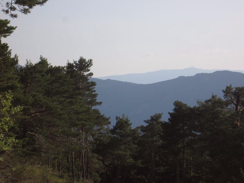
- Panorama
Outlook
The Suquet ridge’s path offers many outlooks where you can admire Rosanais valley and the outset of La Drôme through the Pommerol pass.
More information
Report a problem or an error
If you have found an error on this page or if you have noticed any problems during your hike, please report them to us here: