Our ancestors’ ways
Description
- Take the D 1075 towards Laragne. Continue through to the railway crossing and take the second road on the left (rue Flamenche); then follow the road C 174, on the left, which winds up. Pass the reservoir and the campsite (a shortcut cuts a hairpin bend). Continue straight on to the farm. At the fork, take the left path.
- 500 m further, go down to the right (post "Sous la petite Gineste") in the wood, cross the ravine and go up to the top of the Petite Gineste (776 m). You have there the opportunity to observe the remains of a double dry stone wall, the only remains of an entrenched Ligurian camp. Go down west, then south. Take the footbridge and walk along the small canal to the left.
- Take the stony path on the right and join the D 1075, level with the railway crossing (be careful).
- Cross and follow the D 1075 on the left for 200 m.
- Walk down the 1st path on the right, bypass the leisure center on the right (by turning left, possibility of swimming at the leisure center; 1.6 km round trip). Follow the track which winds its way through the orchards and reaches the bank of the Buëch River. Follow it to the right to quietly return to the starting point.
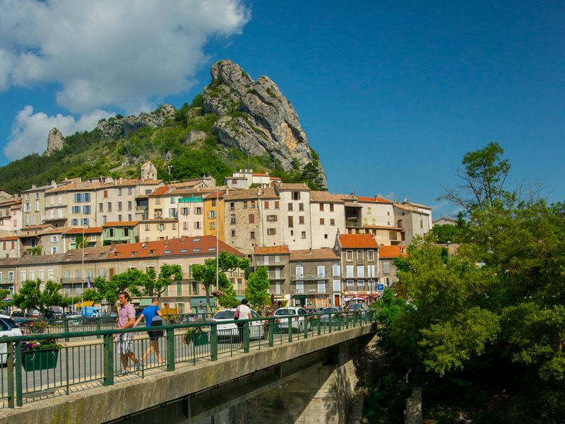
- Departure : Tourist office, Serres
- Arrival : Tourist office, Serres
- Towns crossed : Serres
Forecast
Altimetric profile
Recommandations
Possibility of swimming at the Germanette leisure center (1.6 km round trip from the trail).
Information desks

Transport
Access and parking
Parking :
3 points of interest

 Lake and river
The Buëch River
A tributary of the Durance, the Buëch Riover is a peaceful river that irrigates many apple fields and other orchards along its course. Taking its source in Lus-la-Croix-Haute, the stream stretches for 85 kilometers and drops to an altitude of nearly 2,000 meters.
 Summit
La Petite Gineste
La Gineste and la Petite Gineste are two small peaks overlooking the historic village of Serres. Although low in altitude, the summit of Petite Gineste allows you to see, here and there, the entire Serres-valley.
- Lake and river
Germanette lake and leisure Center
The Germanette lake offers a nice refreshing stop. Composed of three natural pools (for swimming , water and fishing activities) is is an ideal relaxing place for Swimming is supervised from July 1 to August 31. A beach bar is open during the season and a restaurant all year round.
More information
Report a problem or an error
If you have found an error on this page or if you have noticed any problems during your hike, please report them to us here: