Monk path
Description
- Join the fountain on the opposite side of the roundabout, in front of the Tourist Office. Go up "rue Saint-Claude" on the right, then turn left and immediately right to take the "Chemin de la Guérite". Follow then on the opposite side the "rue du Château", and further to the right, climb the stairs of the "chemin de la Chapelle", leading to the Molend tower and the chapel. Continue on the path that winds its way up under the pine trees, passing in front of the Jewish tomb.
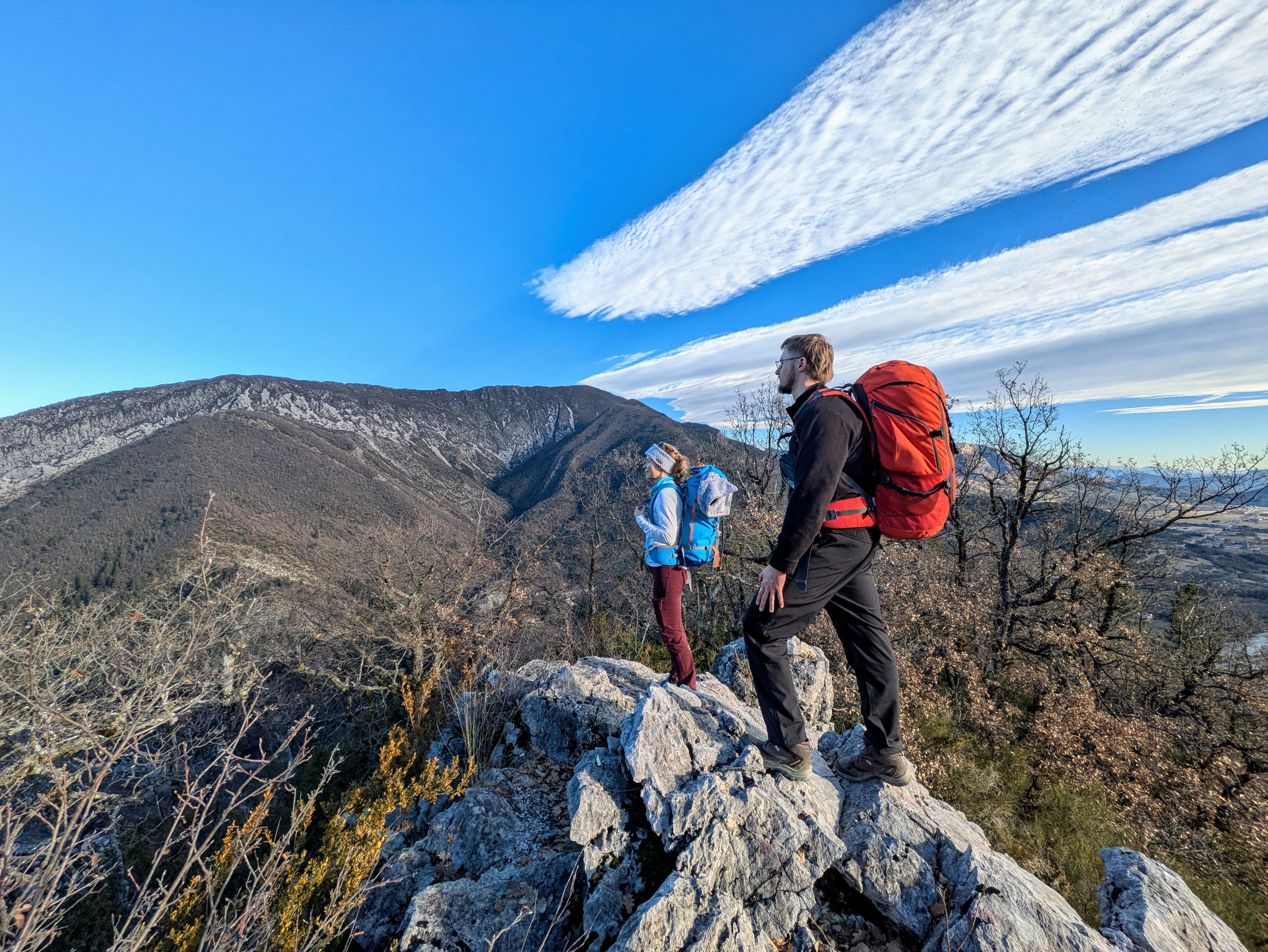
- Go around the pointed rock (842 m) and continue on the ridge of Fontarache. The path follows the ridge among limestone blocks , boxwood and pubescent oaks, up to Col de Saumane (1031 m).
- At the pass, turn left, direction Serres, and 10 m further on to the left, follow the path which crosses the forest track several times.
- At the end of the path, continue on the left by the track and pass in front of the Chapelle de Saumane. The track turns into a tarred track and reaches Serres. Enter the village of Serres and arrive near the college ("Les Ecoles" post). Take the 2nd left to pass on the Esplanade Sainte Catherine (alongside the school). by continuing through the alleys and vaulted passages you’ll reach the Tourist Office.
- Departure : Tourist office, Serres
- Arrival : Tourist office, Serres
- Towns crossed : Serres
Forecast
Altimetric profile
Recommandations
- After returning from the hike, it is highly recommended to visit Serres. This village bears witness to a rich past with vaulted passages (soustets) and more.
Information desks

Transport
Access and parking
Parking :
4 points of interest

 Geology
Pointed rock
This Pointed Rock dominates the Sentier des Moines. It stands out due to its shape. It emerges from the ground and overlooks the surroundings and offers a beautiful view of the village of Serres, its valley and the Buëch river. Its characteristic pointed shape is impressive and makes it the geological specificity of Serres.
- Panorama
Viewpoint
The Sentier des Moines dominates the Serrois valley and offers beautiful views of the area, especially from the ridge Crête de Fontarache .
 Summit
Crête de Fontarache
The Crête de Fontarache is an essential passage between Serres and the Col de Saumane for hikers following the Sentier des Moines.
 Pass
PassSaumane Pass
The Saumane Pass (1029 m) allows you to reach Serres via the Chapelle de Saumane or the ridge Crête de Fontarache. It also allows access to the Rocher de Jardanne and to reach the village of Sigottier. This grassy path, shaded by trees offers an ideal venue for a break or a picnic in calm weather.
More information
Report a problem or an error
If you have found an error on this page or if you have noticed any problems during your hike, please report them to us here: