Bike loop around Chabre
Description
The first kilometers, starting in Laragne-Montéglin, take place on a beautiful and secure road until the Méouge canyon, via Châteauneuf-de-Chabre.
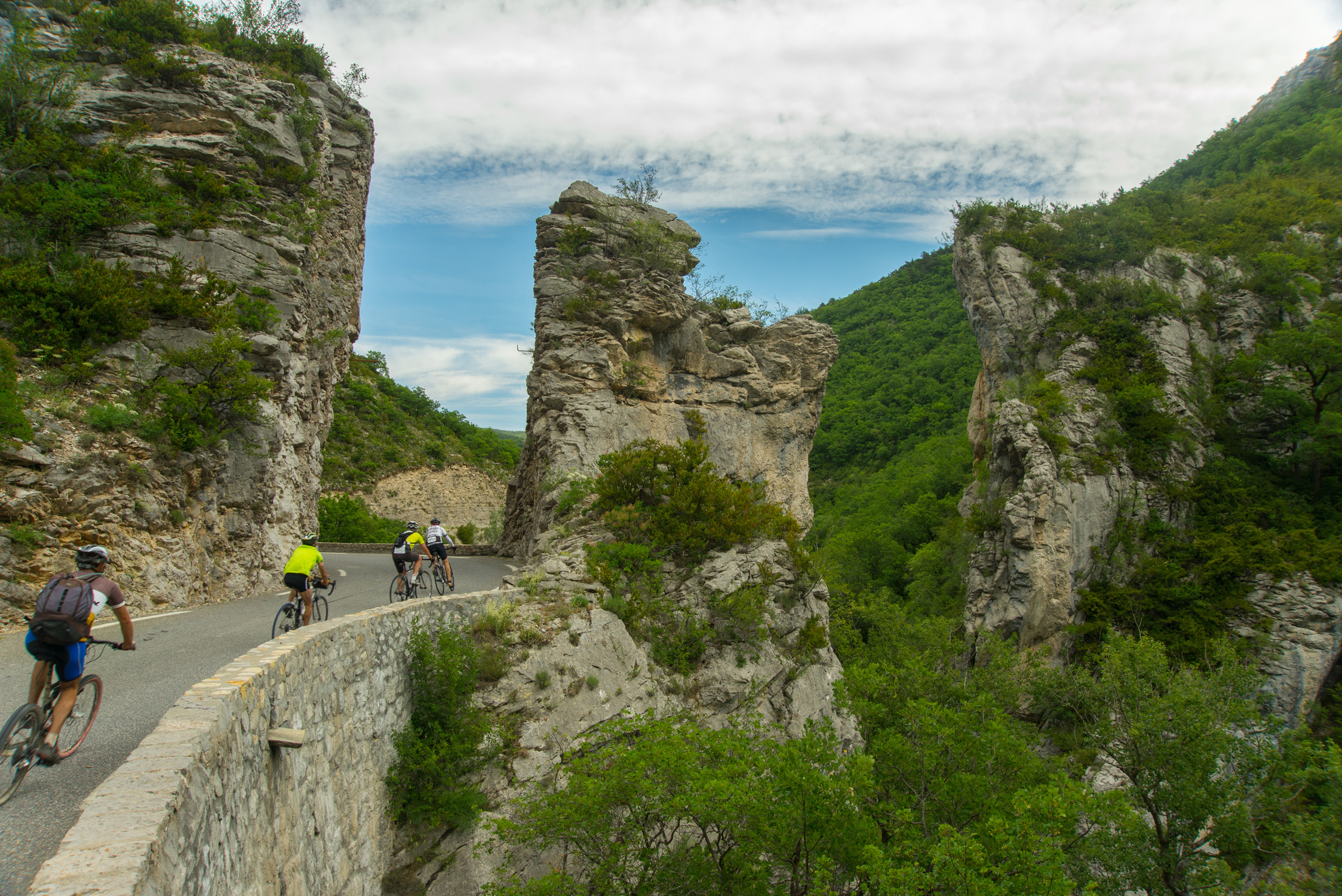
For the crossing of the gorges, natural landscape astonishing by its geological characteristics and its Romanesque bridge, you’ll ride along a winding and slightly uphill road before climbing for a few kilometers in direction Chabre (marked route), which is an internationally renowned site for hang gliding.
Pass the gorges and Barret-sur-Méouge, you’ll continue on a quiet and flat road, colorful and scented, bordered by long fields of lavender; then you’ll enter the Drôme Provençale. After the village of Eygalayes, the Saint-Jean pass begins with its 6 km of slopes approaching 8% declivity.
Once you have reached its summit at 1,159 m above sea level and have taken a look at the panorama of the Ceans valley, you’ll start a descent to Laborel and will continue on the "route des Princes d'Orange" following the course of the Ceans-River direction Orpierre, ancient city of the Baronnies, stronghold of the Princes of Orange in the 11th century. The return to Laragne-Montéglin is a ride through fruit orchards, at the foot of the hilltop village of Lagrand, then towards Saléon through a wooded road with reasonable hilly terrain.
- Departure : Center of the village, Laragne-Montéglin
- Arrival : Center of the village, Laragne-Montéglin
- Towns crossed : Laragne-Montéglin, Val Buëch-Méouge, Barret-sur-Méouge, Saint-Pierre-Avez, Salérans, Ballons, Lachau, Eygalayes, Izon-la-Bruisse, Laborel, Sainte-Colombe, Orpierre, Étoile-Saint-Cyrice, Garde-Colombe, and Saléon
Forecast
Altimetric profile
Recommandations
• The Sisteronais Buëch is labeled "Espace Cyclosport" by the French Cycling Federation and meets quality criteria for welcoming road cyclists.
• The ascent of Col Saint-Jean has slopes of around 8%.
Information desks

Place du village, 05700 Orpierre

Place des Aires, 05300 Laragne-Montéglin
Transport
- Limit travelling, use public transportation and carpooling: www.pacamobilite.fr
Access and parking
Parking :
1 point of interest

 Geology
The Méouge canyon
Shaped by the same named stream , the Gorges de la Méouge are breathtaking. Protected site (Natura 2000 Zone), the gorges offer marvelous viewpoints accessible by the surrounding trails.
More information
Report a problem or an error
If you have found an error on this page or if you have noticed any problems during your hike, please report them to us here: