Maraysse
Valdoule Hard
Hard
Maraysse
3h
4,1km
+400m
-405m
Loop
Embed this item to access it offline
Description
- At the sign "Les Garenses" take the left path which cuts a winding track, to reach the Col du Casset (1242 m).
- At the pass (picnic table), follow the Maraysse ridge, to the right, on a narrow and technical path. Halfway on the ridge, leave the ridge and take a cross path along the south side: be cautious and stay focused. You’ll then reach the top of Maraysse (1567 m) with its cross. Take, on the southwest side, a very steep passage (remain attentive). At the foot of this corridor, the well-marked path continues to the west under the cliff. The path joins a grassy ledge and the ridge (1504 m).
- The trail goes down quickly to the right through a clearing, then it enters the beech grove (check and spot well the path that runs down between the trees and is difficult to see). Steep at first , the trail becomes easier up to the pine forest (look out for the markings).
- At an intersection (1210 m), you’ll meet a well-marked path that you’ll follow to the right until you reach a forest track (at a bend). Follow it, on the left, downhill, to go back to your starting point.
- Towns crossed : Valdoule and Ribeyret
Forecast
Altimetric profile
Recommandations
- Itinerary for experienced hikers. The ridge passages require agility and ease in a vertical environment.
- Possible variant for those who do not want to drive through the forest track: park along the D 26 and follow the track up to the sign "Les Garenses". Continue along the marked path ( 5.5 km and 225 m difference of altitude is added).
Information desks

Transport
Think about public transport and carpooling: https://zou.maregionsud.fr
Access and parking
From Serres (20 km), take the D 994, direction Rosans. 2 km after l'Epine, follow the D 26 to the right, direction La Motte Chalancon. Go down the Col des Tourettes, and take the 1st wide forest track on the left after a pond next to the road. Drive up this track and park 1.5 km after the 2nd curve, at the sign "Les Garenses".
Parking :
Parking "Les Garenses" car park, on the Garenses Montmorin forest track
2 points of interest

 Geology
Arche de Maraysse
Located on the Maraysse crest hike, a small arch is located below the path. This geological formation both entertains and questions, but above all impresses with its singularity.- Geology
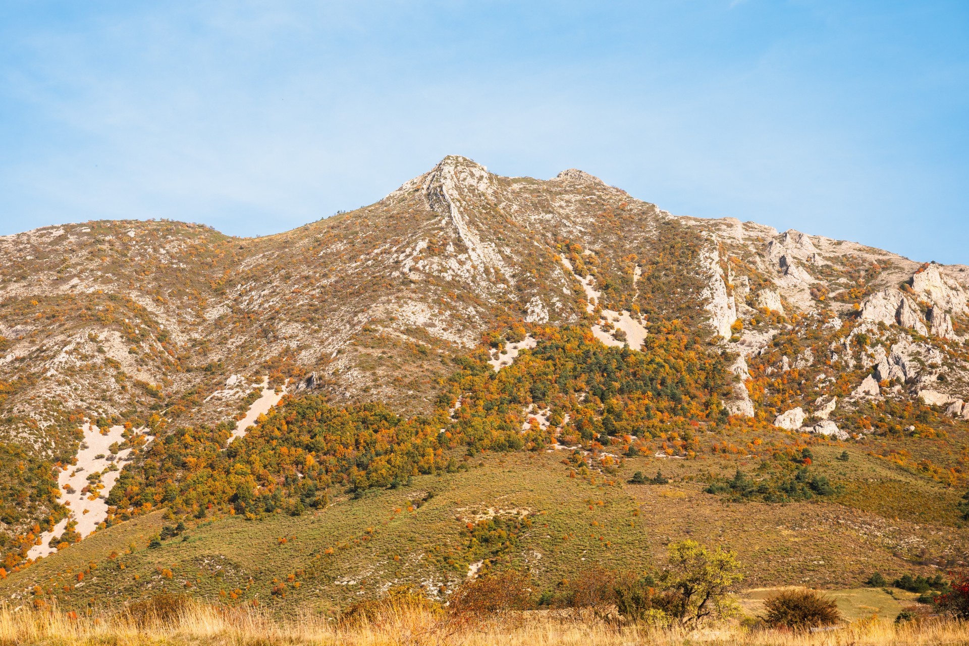
The mountain of Maraysse
The Montagne de Maraysse, located in the Oule valley, seems inaccessible at first glance. However, a technical path allows one to get there and thus offers a splendid panorama on the valleys of Oule and Rosans. Further, you can admire the mountains of Lure, The Mont Ventoux as well as the Dévoluy massif.
More information
Report a problem or an error
If you have found an error on this page or if you have noticed any problems during your hike, please report them to us here: