Other version of the Méouge canyon loop
Description
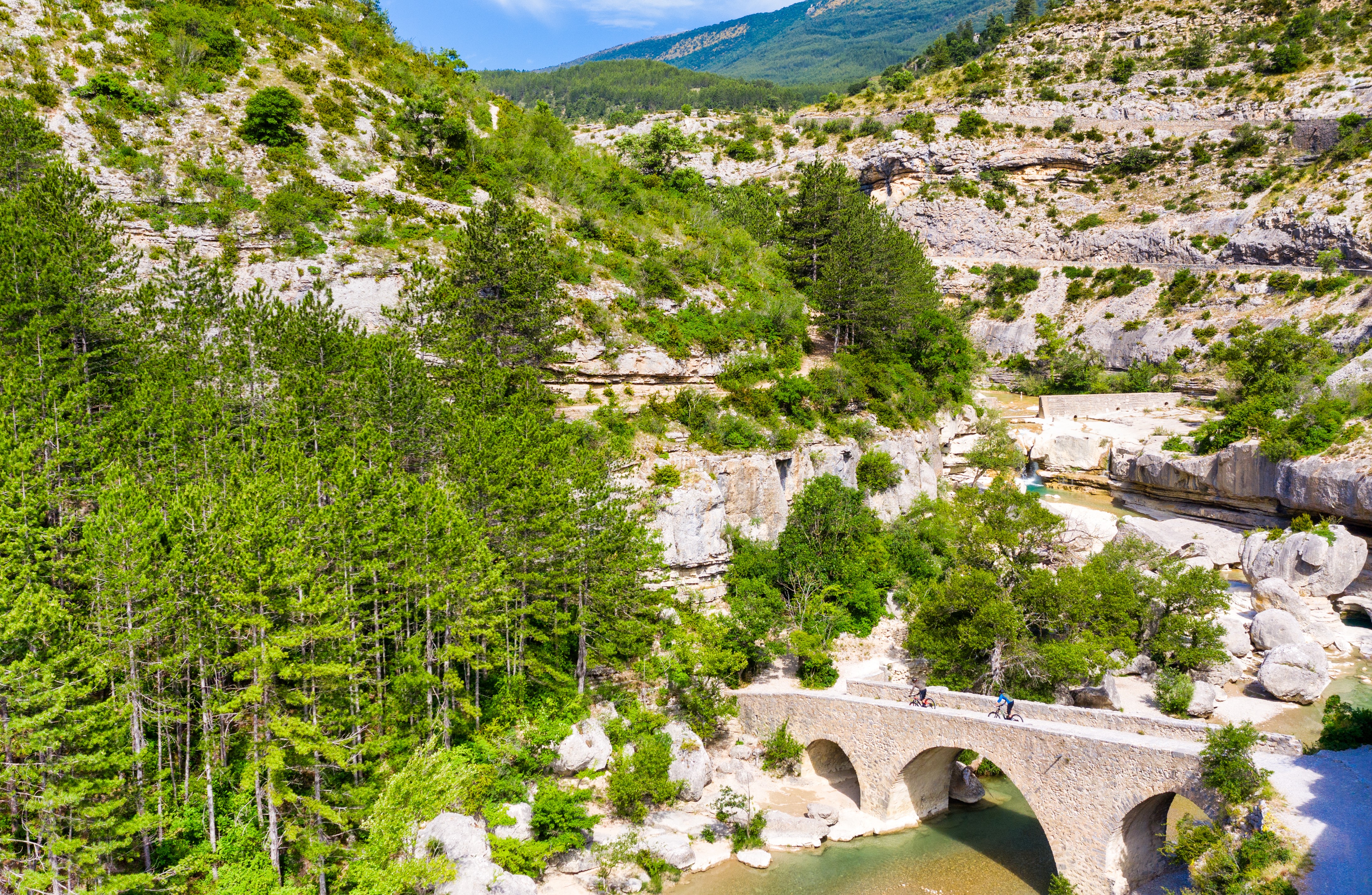
- Follow up the D 942 for 100 m, take the path below the wall and cross the Roman bridge (the ruins of the Pomet mill washed away by the 1901 flood are on the right). Go up the left path.
- At the fork, take the right path (direction "Saint-Pierrre-d'Avez"). It leads you through the gorges like on a roller coaster. After the picnic area, leave the path on the right that goes towards the footbridge, walk up to the left, then stay to the right (direction "Rocher du Château"). The trail crosses continuously. Climb the steep path and walk straight on.
- At the little pass which dominates the Roche Coupée, enjoy the viewpoint and descend. The roller coaster path, sometimes dug into the cliff, continues close to the Méouge (short narrow damages passages!). Go around the rock of the Castle (twisted natural tower, remain from erosion). After the steep path and the crossing, you reach an intersection.
- Follow the path on the right (direction "Barret-sur-Méouge"). Go down the slope, ford the torrent d'Ourse and go up. At the post 367, go down the D 124a then follow the D 942 to the right for 150 m.
-
Climb the path on the left in the garrigue (direction "Pomet"). Continue on a roller coaster path to the ridge (viewpoint). Go down the slope on the other side, turn left and go across for reaching a second ridge, overlooking the Roche Coupée. Go down to the left to the pine plantation. Continue sideways then downhill. Ford the Peysson torrent, go up on the opposite side in the pine forest and reach a large clearing on the ridge (landing zone for paragliders). Take the track on the left.
-
Go down the road on the right for 2 km, cross the bridge and turn right towards Pomet.
- Do not go up in the hamlet, but continue by the road below. It overlooks the Méouge, passes the Banc du Bouc (viewpoint indicator) and leads back to the parking lot.
- Departure : Pont Roman, Pomet
- Arrival : Pont Roman, Pomet
- Towns crossed : Val Buëch-Méouge, Saint-Pierre-Avez, and Barret-sur-Méouge
Forecast
Altimetric profile
Recommandations
-
Loop hike not recommended in winter nor after violent storms (ice waterfalls in the gorges)
Information desks

Place des Aires, 05300 Laragne-Montéglin
Transport
- Let’s limit our trips and use public transportation and carpooling: https://zou.maregionsud.fr
Access and parking
Parking :
1 point of interest
 Panorama
Point of view
The Peysson loop trail offers beautiful views. It opens on a wide panorama onto the Gorges de la Méouge, the Laragne valley and the village of Saint-Pierre-Avez.
More information
Report a problem or an error
If you have found an error on this page or if you have noticed any problems during your hike, please report them to us here: