Crête de Chabre
Barret-sur-Méouge Medium
Crête de Chabre
2h30
7km
+475m
-475m
Loop
Embed this item to access it offline
Description
-
From the Col de la Crousette (925 m), take the path that goes up to the Col St Ange.Just before the pass (1193 m), go right towards the paragliding site. Continue straight ahead to reach the ridge.
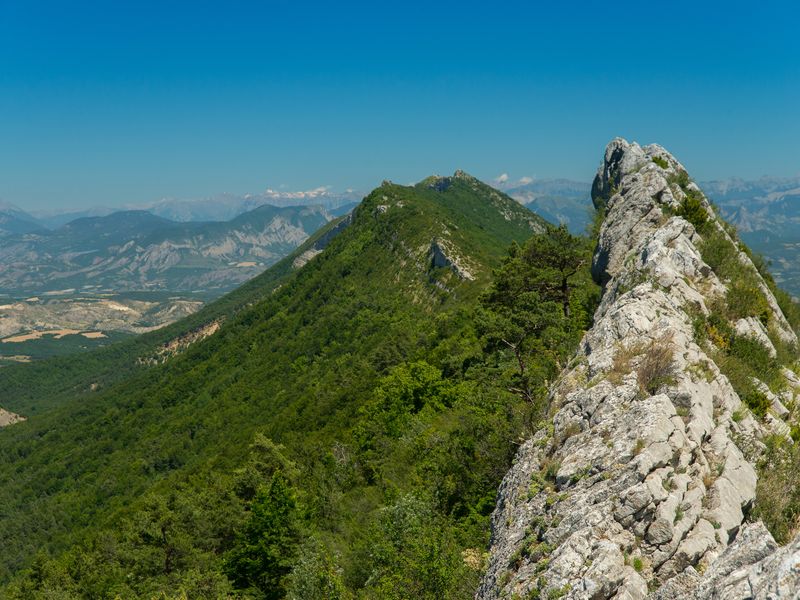
- The Col St Ange (1235 m) is a privileged passage between the Méouge valley and the Baronnies. Ignore the path straight ahead that reaches Orpierre and continue to the left on the ridge via the GR (red and white marking). After a rocky and open passage, the path becomes more shaded.
- At the Pas de Ste Colombe (1201 m), leave the GR and enjoy the panorama of the village of Sainte Colombe below. The return path is on the left. In the first bend, continue on the path on the opposite side.
- At the crossroads (1005 m), the path joins up with motorable tracks. Continue straight on to the starting point.
- Departure : Col de la Crousette, Barret-sur-Méouge
- Arrival : Col de la Crousette, Barret-sur-Méouge
- Towns crossed : Barret-sur-Méouge, Sainte-Colombe, and Ballons
Forecast
Altimetric profile
Recommandations
-
Quite sharp ridge with passing over several rocks. People who suffer from vertigo may be embarrassed.
Information desks

Place du village, 05700 Orpierre

Place des Aires, 05300 Laragne-Montéglin
Transport
- Let’s limit our trips and use public transportation and carpooling: https://zou.maregionsud.fr/
Access and parking
From Sisteron (28 km), follow the D 948 to Plan / Antonaves, then the D 942 to Col de la Crousette (925 m).
Parking :
Col de la Crousette parking lot, in Barret-sur-Méouge
1 point of interest

 Pass
PassCol de Saint-Ange
Located on the mountain of Chabre, the Col de St-Ange stands out due to the impressive cliffs that surround it. A climbing site is located there.
More information
Report a problem or an error
If you have found an error on this page or if you have noticed any problems during your hike, please report them to us here: